
A Practical Quiz on Map Symbols With Explanations
A learner-friendly quiz on map symbols, contour lines, scale bars, legends, dashed paths, north arrows, and source-aware map reading.
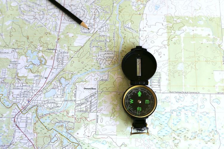
A Practical Quiz on Map Symbols With Explanations
Map symbols are small, but they carry a lot of meaning. A dashed line, contour shape, blue patch, airport icon, scale bar, or north arrow can change how you understand distance, terrain, access, and risk. This quiz is designed for learners who want to read maps more carefully, not just memorize icons.
Editorial note: This Quiz Voyage article is educational content for general readers and students. It is not navigation, hiking safety, aviation, marine, or emergency advice. If you are planning real travel in remote terrain, use current official maps, weather information, local guidance, and suitable equipment. The U.S. Geological Survey explains many basics of topographic maps through its <a href=“https://www.usgs.gov/programs/national-geospatial-program/topographic-maps”>topographic map resources</a>, and Ordnance Survey offers UK-focused map-reading guidance at <a href=“https://getoutside.ordnancesurvey.co.uk/guides/beginners-guides-map-reading/”>GetOutside</a>.
How to Use This Map Symbols Quiz
We recommend trying each answer before reading the explanation. If you are studying with someone else, explain the clue that led you there. The useful habit is not just choosing the correct option; it is learning whether you noticed color, line style, scale, access, date, or terrain.
1. A set of brown lines forms tight rings on a map. What is the most likely meaning?
A. A lake with waves
B. A hill or depression shown by contour lines
C. A railway junction
D. A political boundary
Answer: B. Brown contour lines show elevation on many topographic maps. Tight rings often mean steep change. Whether the feature is a hill or depression depends on labels, hachures, and surrounding elevations. The key idea is that contour spacing affects how steep the land is likely to feel.
2. Why does a scale bar matter if the map already shows roads?
A. It tells you the paper size
B. It converts map distance to ground distance
C. It labels the newest road
D. It replaces the legend
Answer: B. A scale bar helps convert a distance on the map into real-world distance. Roads can look short or long depending on zoom level, page size, and projection. Without scale, a neat map can mislead your sense of time and effort.
3. A blue line gets wider as it moves downstream. What does that usually suggest?
A. A river or stream becoming larger
B. A bus route
C. A power cable
D. A hiking-only path
Answer: A. Blue commonly marks water has. A line widening downstream suggests a stream or river gaining volume. Map conventions vary, so the legend still matters, but color and shape are strong clues.
4. What does a map legend do?
A. Shows the author’s biography
B. Explains symbols, colors, and line styles
C. Lists every street alphabetically
D. Measures wind speed
Answer: B. The legend is the key to the map’s visual language. It turns symbols into readable information. Skipping the legend is like reading a chart without knowing what the axes mean.
Quick symbol comparison table
| Feature | Common clue | Why it matters |
|---|---|---|
| Contours | brown lines and elevation labels | terrain, steepness, route difficulty |
| Water | blue lines or shapes | rivers, lakes, marshes, coast |
| Boundaries | dashed or colored lines | parks, districts, property, administration |
| Roads | line width and color hierarchy | route type and relative importance |
| Scale | bar or ratio | real-world distance |
5. A dashed line crosses open land. What should you check before assuming it is walkable?
A. The legend and access rules
B. The nearest café
C. The map title font
D. The color of the compass needle
Answer: A. Dashed lines can represent paths, tracks, boundaries, planned routes, seasonal has, or other meanings depending on the map. Even if it is a path, access may depend on local law, land management, weather, or closures. In the UK, for example, walkers may need to distinguish public rights of way and access land; in the US, a route may cross private land, Bureau of Land Management land, a park boundary, or a seasonal closure.
6. Why can north arrows be less simple than they look?
A. North is always down
B. There can be grid north, true north, and magnetic north
C. The arrow predicts rain
D. The arrow shows the fastest road
Answer: B. For casual city maps, a north arrow usually helps orientation. For navigation, different kinds of north can matter. Magnetic declination changes by place and time, so serious navigation requires current information and appropriate training.
7. If two contour lines are very close together, what should you infer?
A. The slope is likely steep
B. The area is flat
C. The map is broken
D. The road is closed
Answer: A. Close contour lines mean elevation changes quickly over a short horizontal distance. Wide spacing suggests gentler terrain. This is one of the most useful map-reading habits because steepness affects walking, cycling, drainage, and construction.
8. Why can the same city look different on two maps?
A. One of them must be false
B. Maps choose different purposes, scales, projections, and data
C. Street names change every day
D. Symbols have no meaning
Answer: B. A transit map, tourist map, cadastral map, weather map, and topographic map simplify reality differently. A map is a designed model, not the whole place. The right question is whether the map fits your task.
Common mistake: treating color as universal
Blue often means water and green often means parks or vegetation, but conventions are not universal. Some maps use green for traffic speed, ownership, zoning, or elevation. Always check the legend when the stakes are higher than casual browsing.
9. What does “1:25,000” mean on a map?
A. One map unit equals 25,000 of the same unit on the ground
B. The map has 25,000 roads
C. The map was made in the year 25,000
D. The map covers 25,000 countries
Answer: A. A representative fraction gives scale as a ratio. One centimeter on the map equals 25,000 centimeters on the ground. Larger-scale maps show more detail for a smaller area; smaller-scale maps show less detail over a larger area.
10. A map shows a symbol you do not recognize near a route. What is the best next step?
A. Ignore it if the route looks direct
B. Check the legend or official source for that map series
C. Guess from a different map style
D. Cover it with a marker
Answer: B. Unknown symbols can mark restrictions, hazards, services, boundaries, or land has. The legend or official map documentation is the safest reference.
Score guide
8-10 correct: You read symbols as a system, not as decoration.
5-7 correct: You understand basics but should slow down around scale, contours, and access.
0-4 correct: Review legends, scale bars, and contour examples before using maps for planning.
One final map-reading habit
Before trusting a map, ask three questions: What is this map for? How current is it? What does the legend say? Those questions prevent many mistakes. A beautiful map can still be wrong for your purpose, and a plain map can be extremely useful when its symbols are understood.
11. A map shows a marsh symbol near a tempting shortcut. What should you infer?
A. The shortcut is always faster
B. Ground conditions may be wet, sensitive, or hard to cross
C. The mapmaker made a decoration
D. The area has no wildlife
Answer: B. Wetland or marsh symbols warn that the ground may not behave like a normal path. Conditions can change seasonally, and access may be restricted for safety or conservation. Check current local information before treating it as a route.
12. Why do map dates matter?
A. Roads, paths, boundaries, and facilities can change
B. Old maps are always useless
C. New maps never contain mistakes
D. Dates only matter for weather maps
Answer: A. Map age affects reliability. A path may be closed, a road rerouted, a bridge removed, or a facility renamed. Historical maps are valuable for studying the past, but current planning needs current data.
Mini challenge: read before you move
Before using any map for a real task, point to the title, date, scale, legend, and source. Then identify one thing the map does not show. This small pause builds map literacy because every map leaves something out. A transit map may ignore hills. A road map may ignore foot access. A tourist map may simplify distance. Knowing the omission is part of reading the map.
13. Why might a straight line on a map not be a good walking route?
A. Straight lines always show tunnels
B. Terrain, access, water, fences, and roads may make direct travel impossible
C. Straight lines are illegal on maps
D. The shortest line always has the best view
Answer: B. Maps can make distance look simple while terrain and access make movement complicated. A direct route across contours, private land, marsh, or a major road may be slower or unsafe. Route planning needs symbols, not just geometry.
14. What should you check when a map uses shaded relief?
A. Whether the shading is decorative or tied to elevation
B. Whether north has disappeared
C. Whether roads are older than rivers
D. Whether every shadow is a cliff
Answer: A. Shaded relief helps terrain look three-dimensional, but it can also exaggerate slopes visually. Use it with contours, elevation labels, and scale. Do not treat a shadow as a precise measurement.
Why Explanations Matter More Than Scores
A map quiz is useful only if it changes how you look at the next map. When you miss a question, identify the clue you ignored: color, line style, spacing, date, scale, legend, or source. That habit is transferable. The next unfamiliar map will have different symbols, but the same reading discipline applies.
Digital Map Symbols Can Mislead Too
Paper map symbols are not the only ones worth learning. Digital maps add live traffic colors, business pins, satellite layers, hiking overlays, public transport icons, warning triangles, and user-submitted paths. These symbols feel familiar because they are on a phone, but they still need interpretation. A grey path may not be public access. A business pin may be outdated. A satellite image may show a track that is private, flooded, fenced, or seasonal.
A good digital-map habit is to compare layers before acting. Check the base map, satellite view, official park or agency map, and the date or update source where available. For hiking, cycling, or remote travel, a phone map should support official information rather than replace it.
Real-World Mistake: The Straight-Line Shortcut
A common map-reading mistake is choosing the shortest-looking route without reading the symbols around it. A straight line across open space may cross tight contour lines, wet ground, a private boundary, a river without a bridge, or land where access is restricted. On screen, the route looks efficient. On the ground, it becomes slow, unsafe, or simply unavailable.
Before trusting a shortcut, ask four questions:
- What do the line style and color actually mean in this map’s legend?
- Do contours, water, cliffs, marsh, fences, or roads interrupt the route?
- Is access allowed by the land manager or local rules?
- Is the map current enough for the decision?
This case study is why map literacy is more than icon memorization. Symbols are decision clues. Missing one clue can change the whole route.
Two Official Map Series to Recognize
For US learners, USGS topographic quadrangle maps are a useful example because they combine contours, water has, roads, boundaries, and named places in a consistent series. For UK learners, Ordnance Survey Explorer maps are a common example for walking and outdoor planning. Both still require current conditions and local judgment, but they teach a clear visual language.
When a quiz question feels abstract, open one official map and find the symbol in context. Seeing a contour line around a real hill or a dashed path near a real boundary makes the symbol easier to remember.